


Lakeview Voting District, Mohave County, Arizona
About
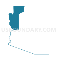
Outline

Summary
| Unique Area Identifier | 525013 |
| Name | Lakeview Voting District |
| County | Mohave County |
| State | Arizona |
| Area (square miles) | 1.82 |
| Land Area (square miles) | 1.60 |
| Water Area (square miles) | 0.22 |
| % of Land Area | 88.03 |
| % of Water Area | 11.97 |
| Latitude of the Internal Point | 34.46222830 |
| Longtitude of the Internal Point | -114.31559620 |
Maps


Graphs
Select a template below for downloading or customizing gragh for Lakeview Voting District, Mohave County, Arizona


Neighbors
Neighoring Voting District (by Name) Neighboring Voting District on the Map
- Voting District 11255, San Bernardino County, CA
- Daytona Voting District, Mohave County, AZ
- Jamaica Voting District, Mohave County, AZ
- Starline Voting District, Mohave County, AZ
- Thunderbolt Voting District, Mohave County, AZ
Top 10 Neighboring County Subdivision (by Population) Neighboring County Subdivision on the Map
Top 10 Neighboring Place (by Population) Neighboring Place on the Map
Top 10 Neighboring Unified School District (by Population) Neighboring Unified School District on the Map
Top 10 Neighboring State Legislative District Lower Chamber (by Population) Neighboring State Legislative District Lower Chamber on the Map
Top 10 Neighboring State Legislative District Upper Chamber (by Population) Neighboring State Legislative District Upper Chamber on the Map
Top 10 Neighboring 111th Congressional District (by Population) Neighboring 111th Congressional District on the Map
Top 10 Neighboring Census Tract (by Population) Neighboring Census Tract on the Map
- Census Tract 9533, Mohave County, AZ (6,256)
- Census Tract 9534.01, Mohave County, AZ (5,427)
- Census Tract 9529, Mohave County, AZ (5,224)
- Census Tract 9531, Mohave County, AZ (2,884)
- Census Tract 9532, Mohave County, AZ (2,657)
- Census Tract 251, San Bernardino County, CA (1,688)